



















In use by fisheries institutions
in 8 countries

FAIMS

Fisheries and Aquaculture Information Management System

Landing sites
468
landing sites sampled
1,232
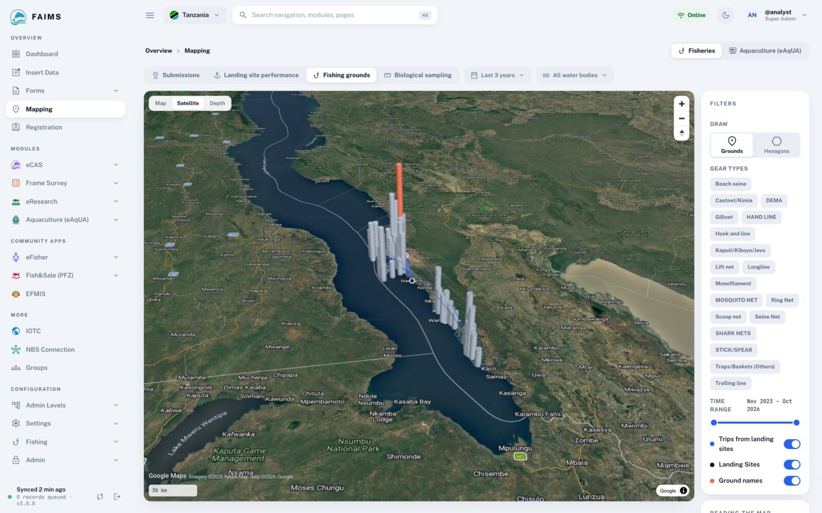
landing sites mapped

Working with fisheries institutions and partners

About FAIMS

Built by the institutions that use it

Fisheries officers, scientists and ICT staff from public institutions build and run FAIMS, and most of them use it in their own work.

Faims collect
fishing trips recorded
486,448
landing sites mapped
1,232
countries with data
8
  • Innocent Edward Sailale
  • Hassan Juma Mpuruti
  • Emmanuel Natalis
  • Hilary Mrosso
  • Zachary Ogari
  • Marie Harline Dorianne Bégué
  • Eric NIYONKURU
  • Evans Chomba Chongo
  • Megan Nyasuguta Kinara
  • Venuste NIMBONA

10 developers from 8 public institutions

How it works

From the landing site to the national report

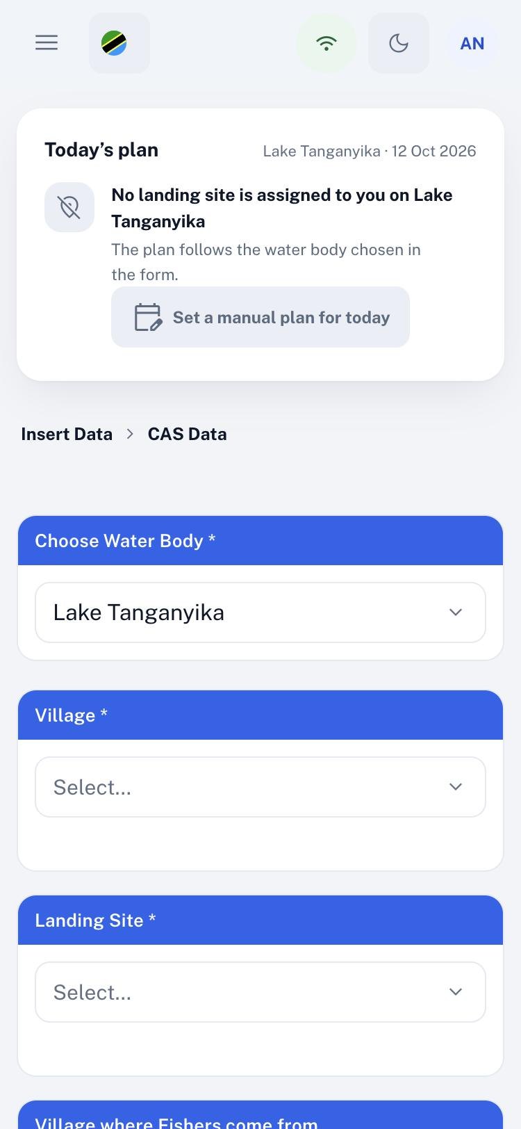
Every figure in FAIMS starts as a record on a phone at a landing site.

Faims collect
Step 01

Collect in the field

Enumerators record catch, fleet and farm data on Android, with or without a network.

Works offline

Records wait on the phone until it finds a signal, so nothing is lost.

Daily targets

Each site gets a number of boats to sample, set from the frame survey.
For managers and analysts

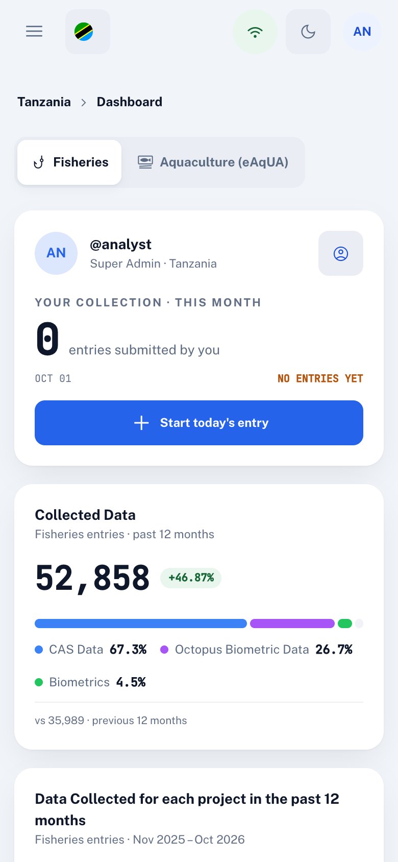
The web platform

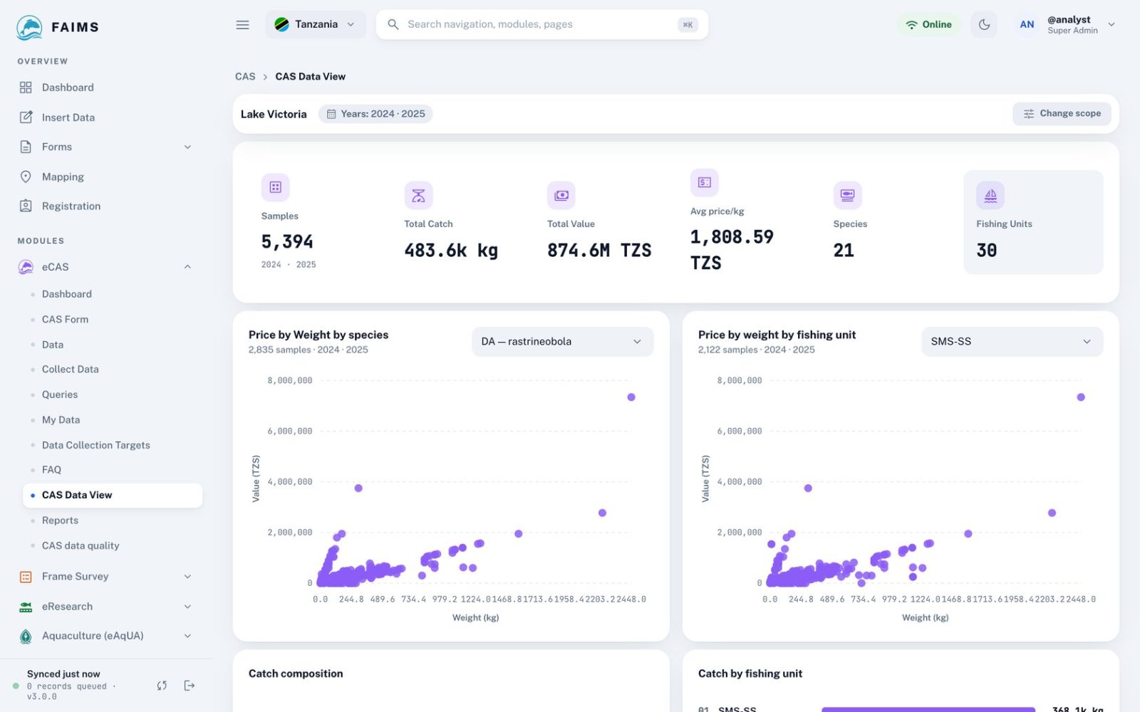
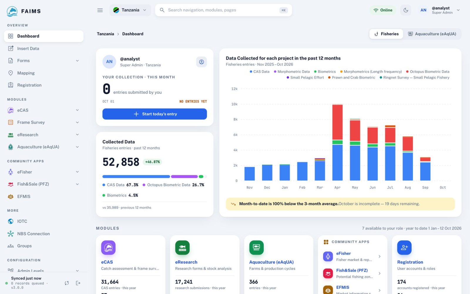
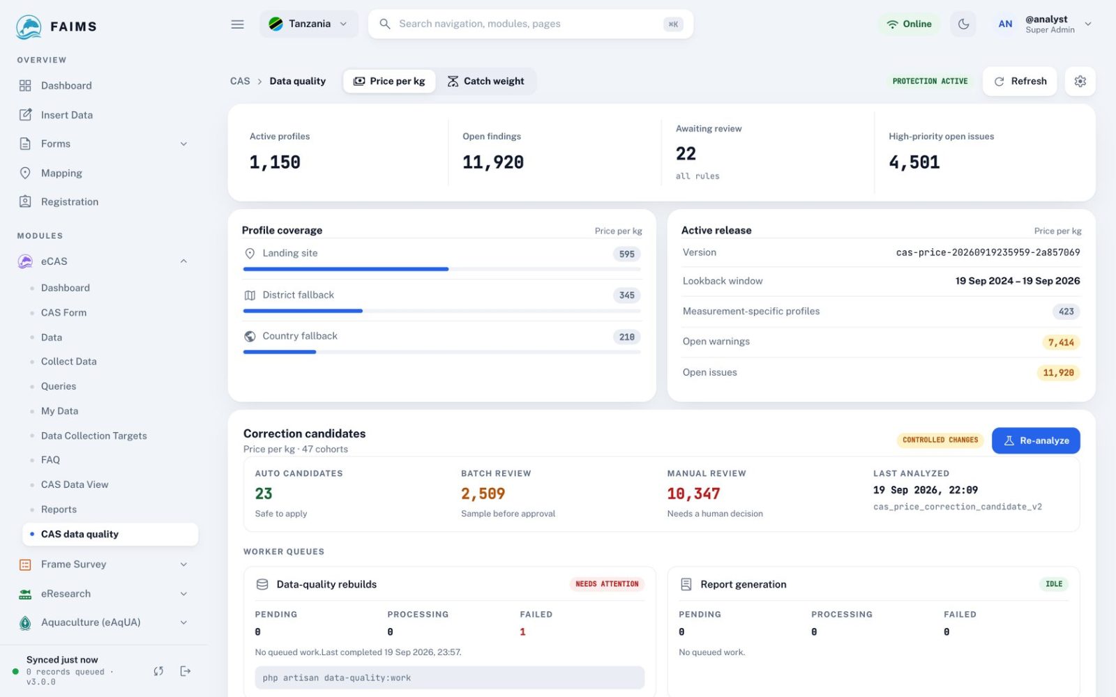
Managers, analysts and district officers work in the FAIMS web platform at app.faims.co. Each person sees the country, district or sites they are responsible for.

app.faims.co/cas
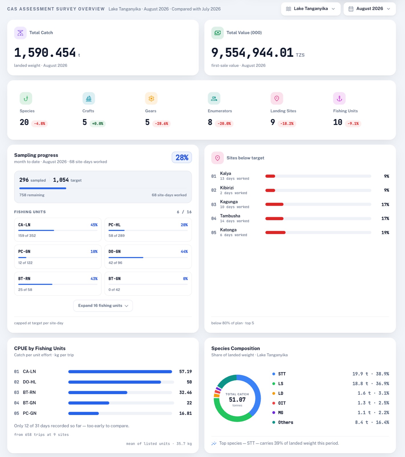
Cas overview

Catch assessment dashboard

Each month for each water body: estimated catch and value, how far sampling got against plan, catch per trip by fishing unit and the species in the catch.

  • Sampling progress against the daily plan
  • Catch per trip by fishing unit
  • Species composition of landed weight
In the field

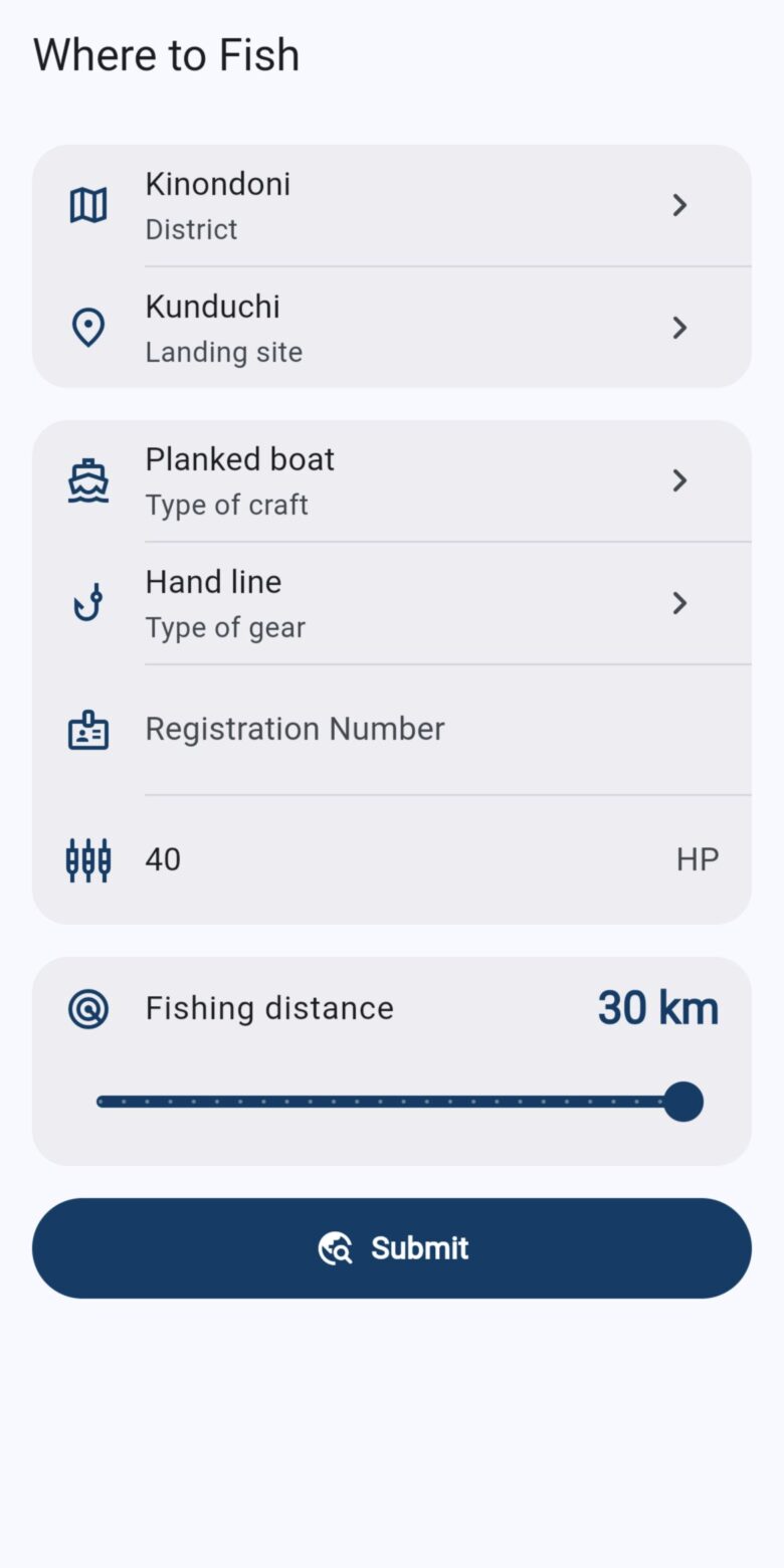
Four apps in the field

Four Android apps carry FAIMS beyond the office: to enumerators at landing sites, to fish farms, and to fishers and traders on the water.

Faims collect Faims dashboard
Works offline, nothing lost when the network drops FAIMS mobile
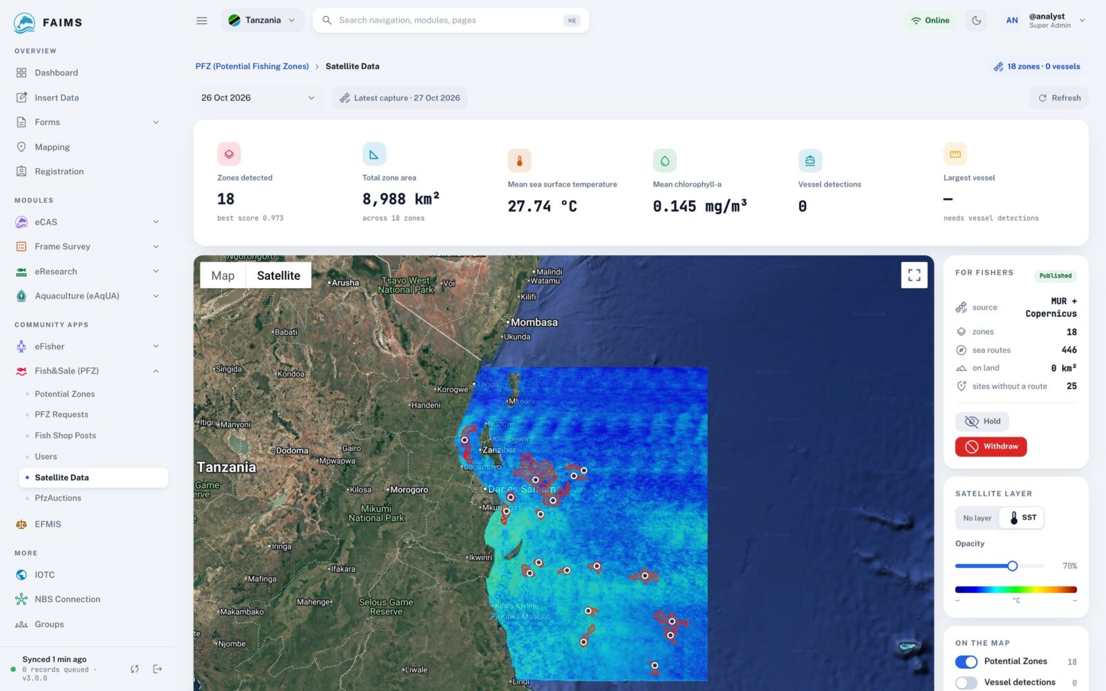
Pfz Plan
Nearby zones with distance and weather PFZ · Fish&Sale
From the data

Results

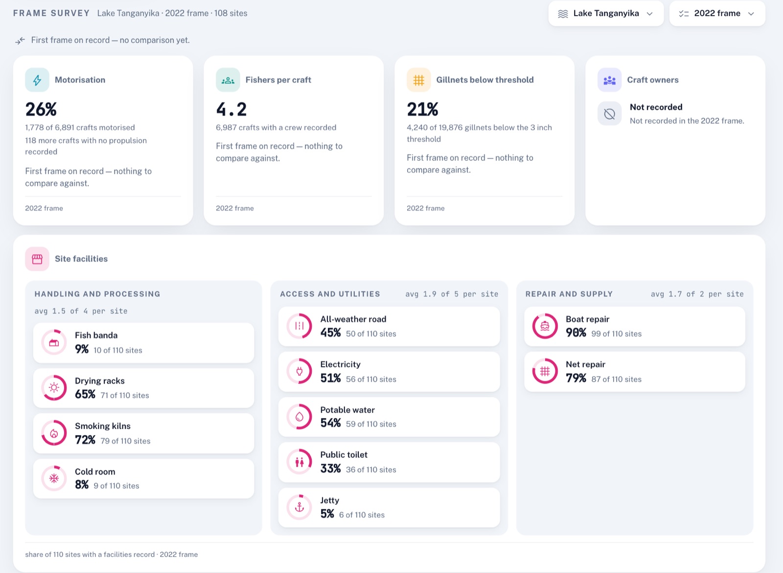
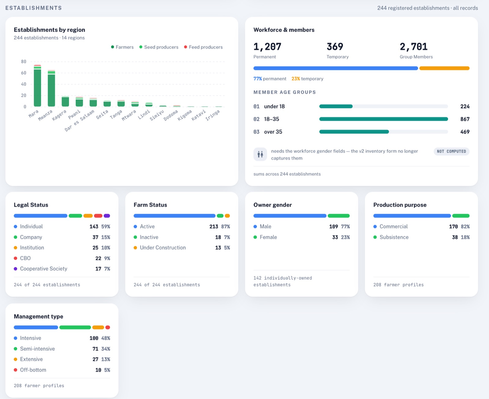
A first look at what FAIMS holds: every mapped landing site, the Lake Victoria fleet over twenty years, and what fishers land on Lake Tanganyika.

Mapped landing sites Landing sites in FAIMS
Lake Victoria (Tanzania) frame surveys Fishers and boats counted in each survey
Fishers and crafts counted in each Lake Victoria (Tanzania) frame survey.
What is landed on Lake Tanganyika (Tanzania) Share of sampled catch weight
Species shares of sampled catch on Lake Tanganyika (Tanzania).

Figures are refreshed from FAIMS every night. They are provisional and not for citation.

Partners

The institutions FAIMS works with

  • Tanzania Fisheries Research Institute
  • Lake Victoria Fisheries Organization
  • Lake Tanganyika Authority
  • Food and Agriculture Organization of the United Nations
  • East African Community
  • Government of the United Republic of Tanzania
  • National Fisheries Resources Research Institute, Uganda
  • Deutsche Gesellschaft für Internationale Zusammenarbeit (GIZ)
  • WWF
  • The Nature Conservancy
Licensing

Free for public institutions

No licence fee for any government, research institution or regional body, now or later.

  • No licence fee
  • Public institutions
Evaluate
Licence fee Free no permission needed

Read, study and audit the source, or run a trial.

Licensing terms

What it covers

  • Read and audit the source
  • Run a trial or a pilot
  • Change it for your own use
  • Collect real survey data
FAQ

Questions institutions ask

What fisheries institutions usually ask before they deploy FAIMS.

Who can use FAIMS?

Government ministries, departments and agencies, public research institutions and universities, intergovernmental bodies and non-profit organisations. A fisheries authority using FAIMS for its public mandate is covered, including when it collects fees or levies.

What does it cost?

There is no licence fee, now or later. The core team offers paid installation, hosting, training and support, but these are never a condition of using the platform.

Does data collection work without a network?

Yes. The Android apps record catch, frame and farm data offline and sync when the phone finds a signal, so nothing is lost when the network drops.

Which languages do the apps support?

FAIMS mobile works in English, French, Portuguese and Swahili. PFZ runs in Kiswahili and English.

How are catch totals estimated?

Sampled trips are raised to fleet totals with the frame survey, by fishing unit and month, following FAO Fisheries Technical Paper 425 and the LVFO catch assessment SOPs.

How do we get started?

Write to the core team with your organisation, the country and fishery, roughly how many users and landing sites, and when you would like to start. We confirm in writing and release the platform to you at no charge.

Get FAIMS

Bring FAIMS to your institution

Write to the core team about a deployment, training or support.